Trail Walking Maple Ridge - Wikiloc - Golden Ears Provincial Park - Photo

Wikiloc - Golden Ears Provincial Park

 Alizée.pee
Alizée.pee

User GUIDE

© OpenStreetMap contributors
Length
Length
22 km
Max alt
Max alt
1366 m
Uphill gradient
Uphill gradient
1364 m
Km-Effort
Km-Effort  
41 km
Min alt
Min alt
140 m
Downhill gradient
Downhill gradient
1365 m
Boucle
Boucle
Yes
Creation date :
2019-08-26 12:50:40.196
Updated on :
2019-08-26 12:53:10.606

(0 Reviews)

Walking
Walking
8h12
Difficulty : Very difficult

Scan this QR Code to open this trail in the SityTrail application

FREE GPS app for hiking

Logo SityTrail SityTrail

IGN / Geographical institutes

Download SityTrail from the App Store Download SityTrail from Google Play

Logo SityTrail SityTrail World

The world is yours!

Download SityTrail from the App Store Download SityTrail from Google Play Download SityTrail on Huawei AppGallery

About

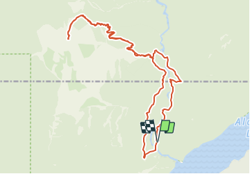
Trail Walking of 22 km to be discovered at British Columbia, Unknown, Maple Ridge. This trail is proposed by Alizée.pee.

Description

Randonnée assez longue, possibilité de se reposer dans un refuge se trouvant sur la route ! Passage par de jolis points d'eau et de jolies montagnes. Attention, il y a souvent de la neige sur les hauteurs, même en été. La randonnée n'est pas des plus évidente mais elle est très belle !

Elevation profile

Positioning

Country:
Canada
Region :
British Columbia
Department/Province :
Unknown
Municipality :
Maple Ridge
Location:
Unknown
Start:(UTM)
539419 ; 5464687 (10U) N.

Trails nearby

Trail Walking Maple Ridge - Wikiloc - Golden Ears Provincial Park, East Canyon Trail - Photo
Walking
GUIDE
Alizée.pee

Walking

Difficult
Maple Ridge, British Columbia, Unknown, Canada
10.1 km | 13.8 km-effort
2h 55min
Yes


Close
My subscriptions